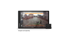
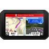
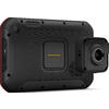
Garmin Overlander Outdoor/off-road Navigation System
Our service

Our Customer Service
Mon - Fri: 9am - 4pm
WE'RE THERE FOR YOU
Contact FormSend us your question regarding this product!
Secure payment with SSL encryption
Free Returns
Product details
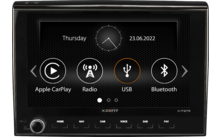
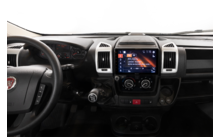
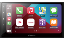
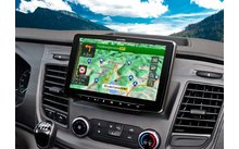
| Onroad/offroad the right navigation |
Product description
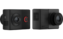
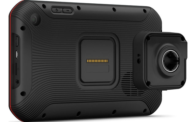
Overlander is a rugged tablet with Android as the operating system. Thanks to its robust construction and the rubber coating on the outer edge, the Overlander is protected against dust according to IP5X protection class and is
resistant to damage from falling objects
according to military standard MIL-STD-810.
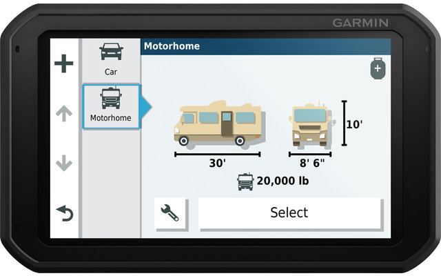
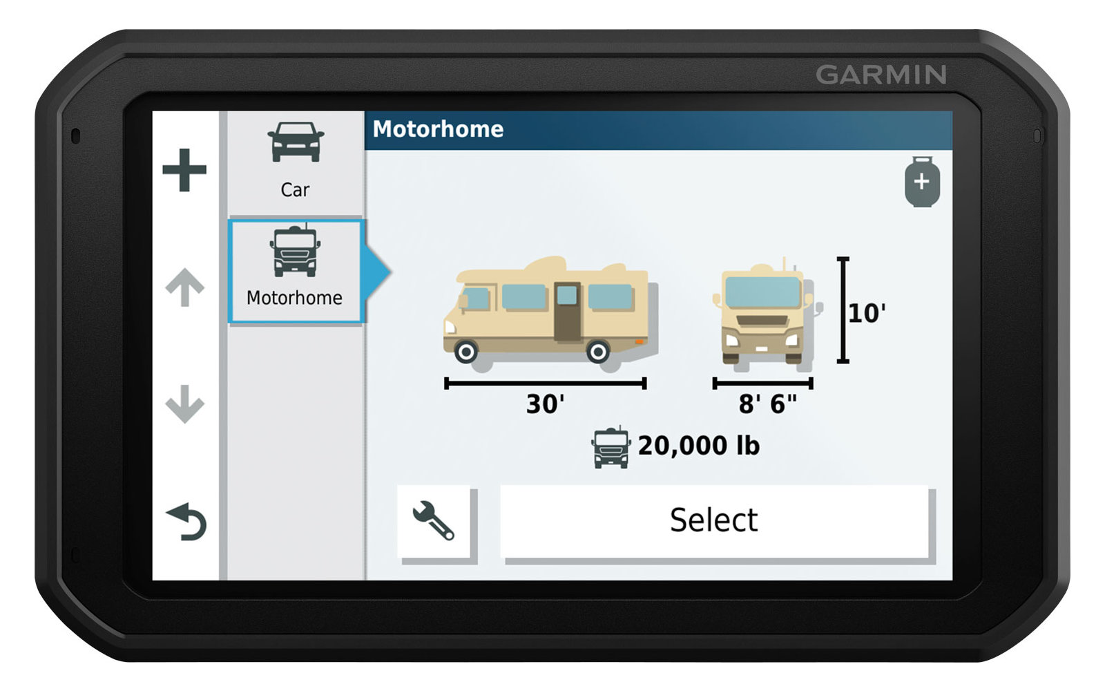
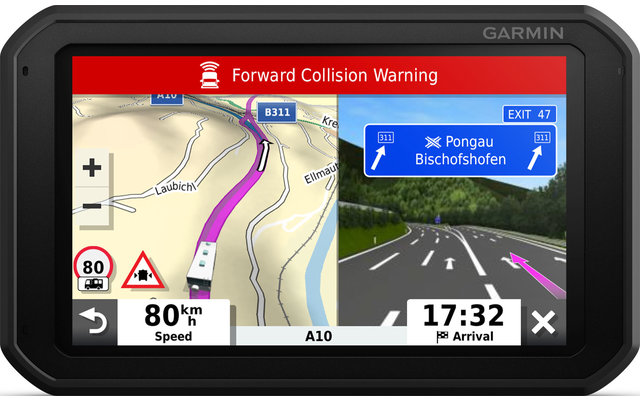
With the new operating concept of the Overlander you can choose between a drive and an explore mode. In Drive mode, solid Garmin maps provide navigation in normal road traffic. In the Explore mode, however, the OpenStreetMap maps are called up with elevation profile data for relief display. In combination with the simultaneous reception of the three largest satellite navigation systems (GNSS), navigation should succeed even in the most remote wilderness. The integrated sensors ensure the display of the current longitudinal and lateral inclination of the vehicle. The driver can thus be warned even when a critical point is reached, which can be set individually. Even compass, altimeter and barometer have been installed in the Overlander
. Traffic information, voice control and inReach services
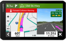
The route guidance in drive mode is adjusted by the overlander based on the set vehicle profile. Garmin provides traffic data for a safe and fast journey via the usual route of digital traffic or via Premium TMC traffic information. To keep your hands on the steering wheel while driving, the drive mode can also be operated via voice control.
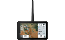
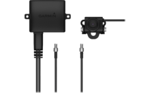
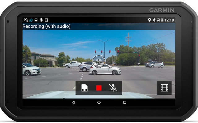
For planning off-road expeditions in the Explore mode, the Garmin Explore app can also be used to plan routes, tracks and waypoints and synchronize them with your GPS, smartphone or computer. Garmin has also expanded its navigation ecosystem with the inReach satellite communication devices. All inReach functions can thus be used directly on the overlander. In case of an emergency, SOS signals can be sent via the large display of the overlander, text messages can be sent to the emergency contacts or own position data can be transmitted. Even current weather data can be called up via the inReach coupling. In order not to lose the overview even in extended Unimogs, buses and various other oversized touring vehicles, up to 4 of the Garmin BC 30 / BC40 rear view cameras can be coupled with the Overlander
The pre-installed POIs (= Points of Interest) from Garmin as well as iOverlander, ACSI, NKC Campercontact, Trailer's PARK, Tracks4Africa, TripAdvisor and Foursquare provide even more orientation in cities and in the hinterland.These can be used to navigate to service points, attractions, public facilities, motels, as well as many destinations for your next camping, hunting or fishing experience.
- All-Terrain-Navi through robust housing and 7-inch touch display
- Map material for road navigation in Europe, the Middle East and Africa
- OpenStreetMap with topographic data for the hinterland with relief representation
- Multi-GNSS by combining GPS, GLONASS and Galileo
- Representation of the longitudinal and lateral inclination of the vehicle
- ABC data (altimeter, barometer, compass)
- Own app for inReach functions (requires separate device)
- Individual route guidance based on the vehicle specifications
- Connectivity and endurance thanks to WLAN and up to 3 hours battery life
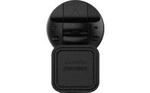
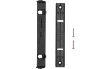
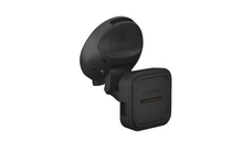
- Comfortable use thanks to active magnetic holder with suction cup holder or RAM mount
Features
| Type navigation systems | Navigation device |
| Bluetooth | |
| ADAC pitch guide | |
| Bluetooth data access | |
| Adjustable camping parameters | |
| Display diagonal | 7 " |
| DVB-T | - |
| DVD player | - |
| FM/AM tuner | - |
| TMC traffic avoidance | |
| ean | 0753759235116 |
| Manufacturer Article No. | 117611 |
Legal information
Manufacturer information
ENO telecom GmbH
Bentheimer Str. 118b
48529 Nordhorn
Germany
j.thiele@eno.de
Our service
Our Customer Service
Mon - Fri: 9am - 4pm
WE'RE THERE FOR YOU
Contact FormSend us your question regarding this product!
Secure payment with SSL encryption
Free Returns